Managing marine recreation use for ecosystem recovery
Share Managing marine recreation use for ecosystem recovery on FacebookShare Managing marine recreation use for ecosystem recovery on X (formerly Twitter)Share Managing marine recreation use for ecosystem recovery on LinkedinEmail Managing marine recreation use for ecosystem recovery link
Project Summary
Cowlitz Bay, Waldron Island. Photo: F.C.Robertson San Juan County's Department of Environmental Stewardship is advancing a coordinated body of research to characterize how marine recreation - vessel traffic, anchoring, and marine infrastructure - affects sensitive nearshore habitats, wildlife, and Indigenous treaty resources across the San Juan Islands Marine Stewardship Area. The islands have been a popular boating destination for decades and are now the number one boating destination in the U.S., but recreational boating is now recognized as a likely but poorly quantified driver of nearshore habitat disturbance, including eelgrass declines. Vessel presence and noise also affect the endangered Southern Resident killer whales and other marine mammals, as well as shoreline birds and other species of cultural and economic importance. Vessel presence and marine infrastructure also impede Tribal access to Usual and Accustomed fishing and harvesting areas. No prior effort has integrated vessel use, mooring buoy infrastructure, ecological stress data, and Traditional Ecological Knowledge from Tribes and other marine users into a single assessment framework for the San Juan Islands. This program closes that gap through four linked components, each building on a shared spatial dataset and feeding into a common set of management and policy recommendations and outcomes.
Project Components
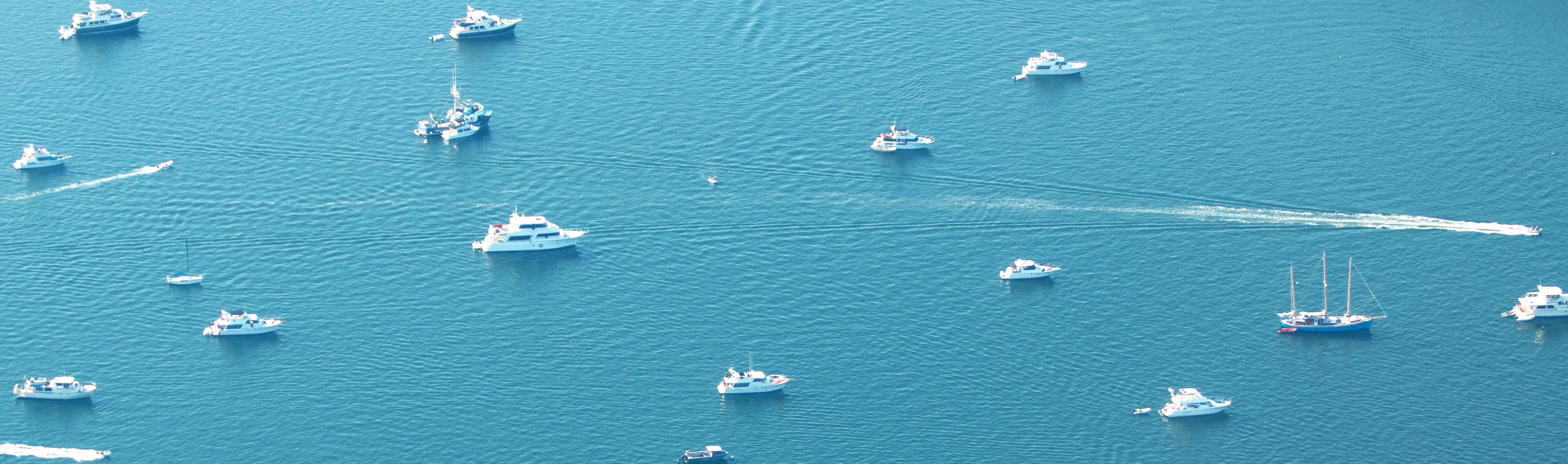
Boater impact - Vessel Density Assessment: Aerial line-transect surveys were flown in 2024 to understand vessel use and density across the Marine Stewardship Area. This effort identified boater hotspots and compared them to marine habitat and species data, including eelgrass, kelp, shellfish, forage fish, marine mammals, and marine birds.
Mooring Buoy Spatial Analysis and Assessment: San Juan County is home to approximately 2000 mooring buoys, which is at least one-third of all mooring buoys in the inland waters of Washington State. This component uses field surveys and aerial imagery to identify and map all mooring and marker buoys present within the San Juan County Marine Stewardship Area. These data will be compared with data collected by Friends of the San Juans in 2010 to determine the number of buoys installed since then and to identify unpermitted mooring buoys. Other study components include creating and piloting a mooring buoy tracking database with WA DNR, upgrading the public mooring buoys at Odlin County Park, and working with Friends of the San Juans to provide environmentally friendly upgrades to residents' mooring buoys to reduce their impact on sensitive eelgrass beds.
Wildlife and Habitat Health Prioritization Assessment: A synthesis of the vessel and mooring buoy datasets and habitat and species data to identify priority areas within the Marine Stewardship Area for additional protections. An initial habitat prioritization exercise was undertaken in 2025 following an ad-hoc expert elicitation approach. The expert elicitation yielded 6 top sites from the identification of 40 sites spread across 16 islands and their associated water bodies. This effort will be repeated as the mooring buoy data is updated and additional data on marine recreation and infrastructure is gathered.
Marine Recreation Access and Capacity Assessment: Spatial analyses will integrate the vessel traffic density and mooring buoy distribution data, shoreline access inventories, habitat prioritization datasets, and species occurrence data to identify areas of cumulative exposure. Ecological synthesis will evaluate documented links between disturbance and stress-related impacts on marine wildlife, anchoring-related degradation of eelgrass affecting juvenile salmon habitat, and indirect effects of prey limitation on at-risk species, such as the endangered Southern Resident killer whale. Tribal observations of species health trends, foraging changes, habitat conditions, and access constraints, informed by participatory engagement guided by Indigenous data sovereignty principles, will be incorporated.
Hooded nudibranch in eelgrass, P. GreenSouthern Resident Orca, J. HoganGreater Yellowlegs & Wilson Snipe, P. Green
,
By explicitly linking recreation patterns to wildlife and habitat health stressors and treaty-reserved resources, this project will equip managers with actionable strategies to reduce cumulative impacts and support recovery of salmon, Southern Resident killer whales, and nearshore habitats across the Marine Stewardship Area and greater Salish Sea region.
Project Partners
This project is in partnership with:
San Juan County Marine Resources Committee,
San Juan County Dept. of Community Development,
The Northwest Straits Commission,
Washington Dept. of Fish and Wildlife,
Washington Dept. of Natural Resources,
The University of Washington Friday Harbor Labs,
Friends of the San Juans,
Local Coast Salish Tribes with Usual and Accustomed fishing and harvesting treaty rights, or ancestral ties to the San Juan Islands.
Project Funding
This project has been funded, wholly or in part, by the United States Environmental Protection Agency under Assistance Agreements CE-01J97401-0 and CE-02198701-0. The contents of this webpage do not necessarily reflect the views and policies of the Environmental Protection Agency, nor does mention of trade names or commercial products constitute endorsement or recommendation for use.
Environmental Stewardship staff and the San Juan County Marine Resources Committee continue to pursue grant opportunities to progress components 3 and 4 of this project.
Project Summary
Cowlitz Bay, Waldron Island. Photo: F.C.Robertson San Juan County's Department of Environmental Stewardship is advancing a coordinated body of research to characterize how marine recreation - vessel traffic, anchoring, and marine infrastructure - affects sensitive nearshore habitats, wildlife, and Indigenous treaty resources across the San Juan Islands Marine Stewardship Area. The islands have been a popular boating destination for decades and are now the number one boating destination in the U.S., but recreational boating is now recognized as a likely but poorly quantified driver of nearshore habitat disturbance, including eelgrass declines. Vessel presence and noise also affect the endangered Southern Resident killer whales and other marine mammals, as well as shoreline birds and other species of cultural and economic importance. Vessel presence and marine infrastructure also impede Tribal access to Usual and Accustomed fishing and harvesting areas. No prior effort has integrated vessel use, mooring buoy infrastructure, ecological stress data, and Traditional Ecological Knowledge from Tribes and other marine users into a single assessment framework for the San Juan Islands. This program closes that gap through four linked components, each building on a shared spatial dataset and feeding into a common set of management and policy recommendations and outcomes.
Project Components
Boater impact - Vessel Density Assessment: Aerial line-transect surveys were flown in 2024 to understand vessel use and density across the Marine Stewardship Area. This effort identified boater hotspots and compared them to marine habitat and species data, including eelgrass, kelp, shellfish, forage fish, marine mammals, and marine birds.
Mooring Buoy Spatial Analysis and Assessment: San Juan County is home to approximately 2000 mooring buoys, which is at least one-third of all mooring buoys in the inland waters of Washington State. This component uses field surveys and aerial imagery to identify and map all mooring and marker buoys present within the San Juan County Marine Stewardship Area. These data will be compared with data collected by Friends of the San Juans in 2010 to determine the number of buoys installed since then and to identify unpermitted mooring buoys. Other study components include creating and piloting a mooring buoy tracking database with WA DNR, upgrading the public mooring buoys at Odlin County Park, and working with Friends of the San Juans to provide environmentally friendly upgrades to residents' mooring buoys to reduce their impact on sensitive eelgrass beds.
Wildlife and Habitat Health Prioritization Assessment: A synthesis of the vessel and mooring buoy datasets and habitat and species data to identify priority areas within the Marine Stewardship Area for additional protections. An initial habitat prioritization exercise was undertaken in 2025 following an ad-hoc expert elicitation approach. The expert elicitation yielded 6 top sites from the identification of 40 sites spread across 16 islands and their associated water bodies. This effort will be repeated as the mooring buoy data is updated and additional data on marine recreation and infrastructure is gathered.
Marine Recreation Access and Capacity Assessment: Spatial analyses will integrate the vessel traffic density and mooring buoy distribution data, shoreline access inventories, habitat prioritization datasets, and species occurrence data to identify areas of cumulative exposure. Ecological synthesis will evaluate documented links between disturbance and stress-related impacts on marine wildlife, anchoring-related degradation of eelgrass affecting juvenile salmon habitat, and indirect effects of prey limitation on at-risk species, such as the endangered Southern Resident killer whale. Tribal observations of species health trends, foraging changes, habitat conditions, and access constraints, informed by participatory engagement guided by Indigenous data sovereignty principles, will be incorporated.
Hooded nudibranch in eelgrass, P. GreenSouthern Resident Orca, J. HoganGreater Yellowlegs & Wilson Snipe, P. Green
,
By explicitly linking recreation patterns to wildlife and habitat health stressors and treaty-reserved resources, this project will equip managers with actionable strategies to reduce cumulative impacts and support recovery of salmon, Southern Resident killer whales, and nearshore habitats across the Marine Stewardship Area and greater Salish Sea region.
Project Partners
This project is in partnership with:
San Juan County Marine Resources Committee,
San Juan County Dept. of Community Development,
The Northwest Straits Commission,
Washington Dept. of Fish and Wildlife,
Washington Dept. of Natural Resources,
The University of Washington Friday Harbor Labs,
Friends of the San Juans,
Local Coast Salish Tribes with Usual and Accustomed fishing and harvesting treaty rights, or ancestral ties to the San Juan Islands.
Project Funding
This project has been funded, wholly or in part, by the United States Environmental Protection Agency under Assistance Agreements CE-01J97401-0 and CE-02198701-0. The contents of this webpage do not necessarily reflect the views and policies of the Environmental Protection Agency, nor does mention of trade names or commercial products constitute endorsement or recommendation for use.
Environmental Stewardship staff and the San Juan County Marine Resources Committee continue to pursue grant opportunities to progress components 3 and 4 of this project.
Managing marine recreation use for ecosystem recovery has finished this stage
Aerial line transect surveys were completed in 2024 and a density assessment was completed in 2025.
Identification and mapping of mooring buoys
Managing marine recreation use for ecosystem recovery has finished this stage
An initial review of aerial photography to identify and map mooring buoys was completed in 2023.
Final vessel assessment and habitat prioritization report completed
Managing marine recreation use for ecosystem recovery is currently at this stage
The final outcomes of the vessel assessment, including density analysis and initial habitat prioritization effort, are provided in this final report.
Field verification surveys for mooring buoys
this is an upcoming stage for Managing marine recreation use for ecosystem recovery
Field surveys began as funding allowed in 2024, to count and identify mooring and marker buoy locations. Dedicated funding became available in 2026 allowing these surveys to be completed. These data will be used to verify the aerial photography data.
Assessing decadal change in mooring buoy presence and regulatory status
this is an upcoming stage for Managing marine recreation use for ecosystem recovery
Our survey data will be compared to the data collected by Friends of the Sans Juans in 2010 to identify those buoys that have been installed since 2010. These data will form the basis of a regulatory status of mooring buoys to identify those that have been installed without the required permits.
Wildlife and Habitat Health Prioritization Assessment
this is an upcoming stage for Managing marine recreation use for ecosystem recovery
An initial ad hoc expert elicitation to identify priority areas for protection was conducted in 2025. This exercise will be repeated once the mooring buoy data is updated and spatially integrated.
Marine Recreation Access and Capacity Assessment
this is an upcoming stage for Managing marine recreation use for ecosystem recovery
Currently seeking grant funding to support this component.
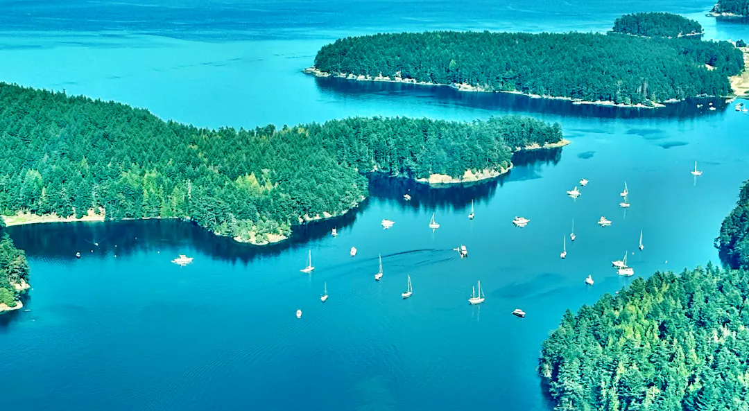
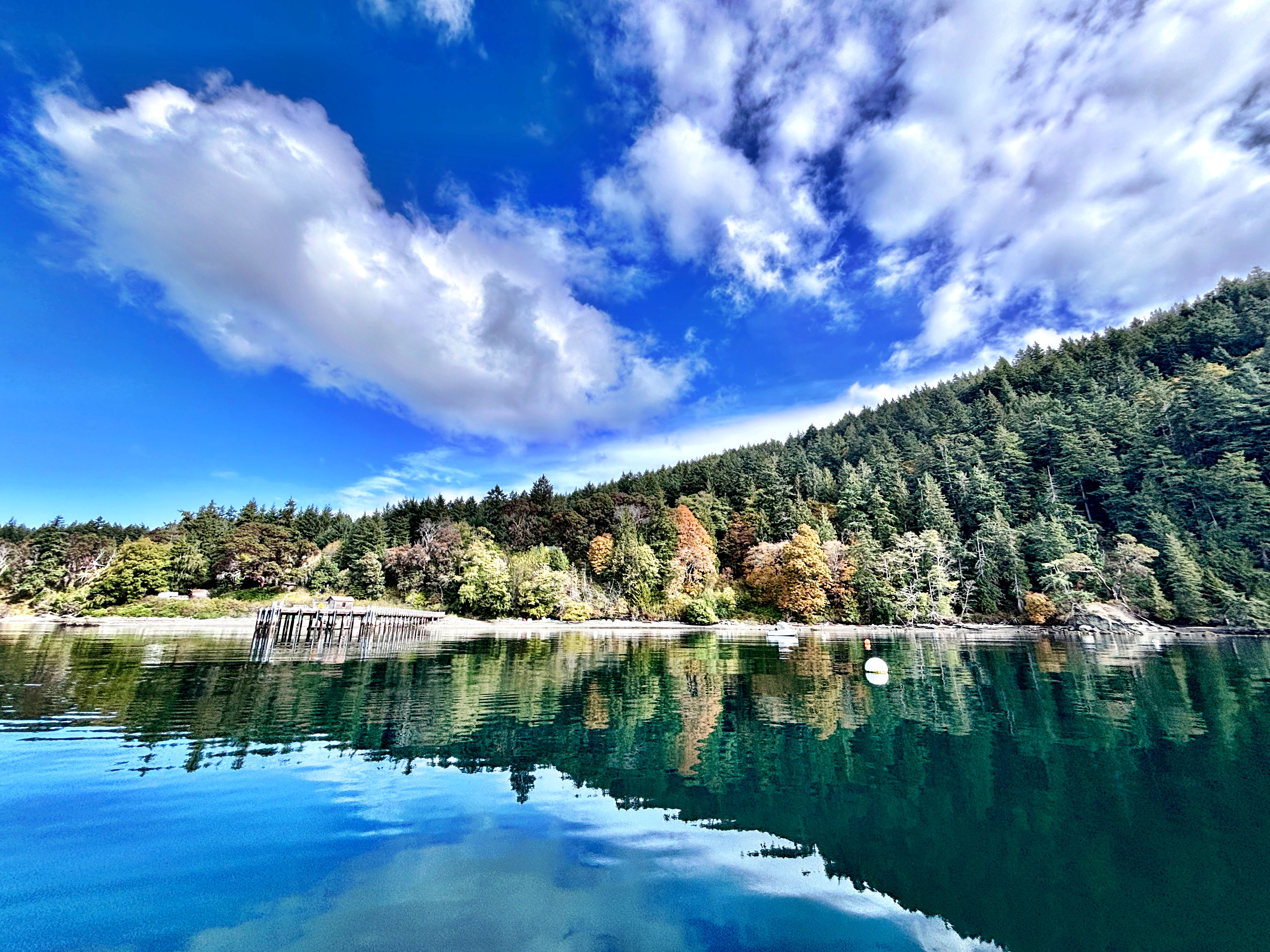 Cowlitz Bay, Waldron Island. Photo: F.C.Robertson San Juan County's Department of Environmental Stewardship is advancing a coordinated body of research to characterize how marine recreation - vessel traffic, anchoring, and marine infrastructure - affects sensitive nearshore habitats, wildlife, and Indigenous treaty resources across the San Juan Islands Marine Stewardship Area. The islands have been a popular boating destination for decades and are now the number one boating destination in the U.S., but recreational boating is now recognized as a likely but poorly quantified driver of nearshore habitat disturbance, including eelgrass declines. Vessel presence and noise also affect the endangered Southern Resident killer whales and other marine mammals, as well as shoreline birds and other species of cultural and economic importance. Vessel presence and marine infrastructure also impede Tribal access to Usual and Accustomed fishing and harvesting areas. No prior effort has integrated vessel use, mooring buoy infrastructure, ecological stress data, and Traditional Ecological Knowledge from Tribes and other marine users into a single assessment framework for the San Juan Islands. This program closes that gap through four linked components, each building on a shared spatial dataset and feeding into a common set of management and policy recommendations and outcomes.
 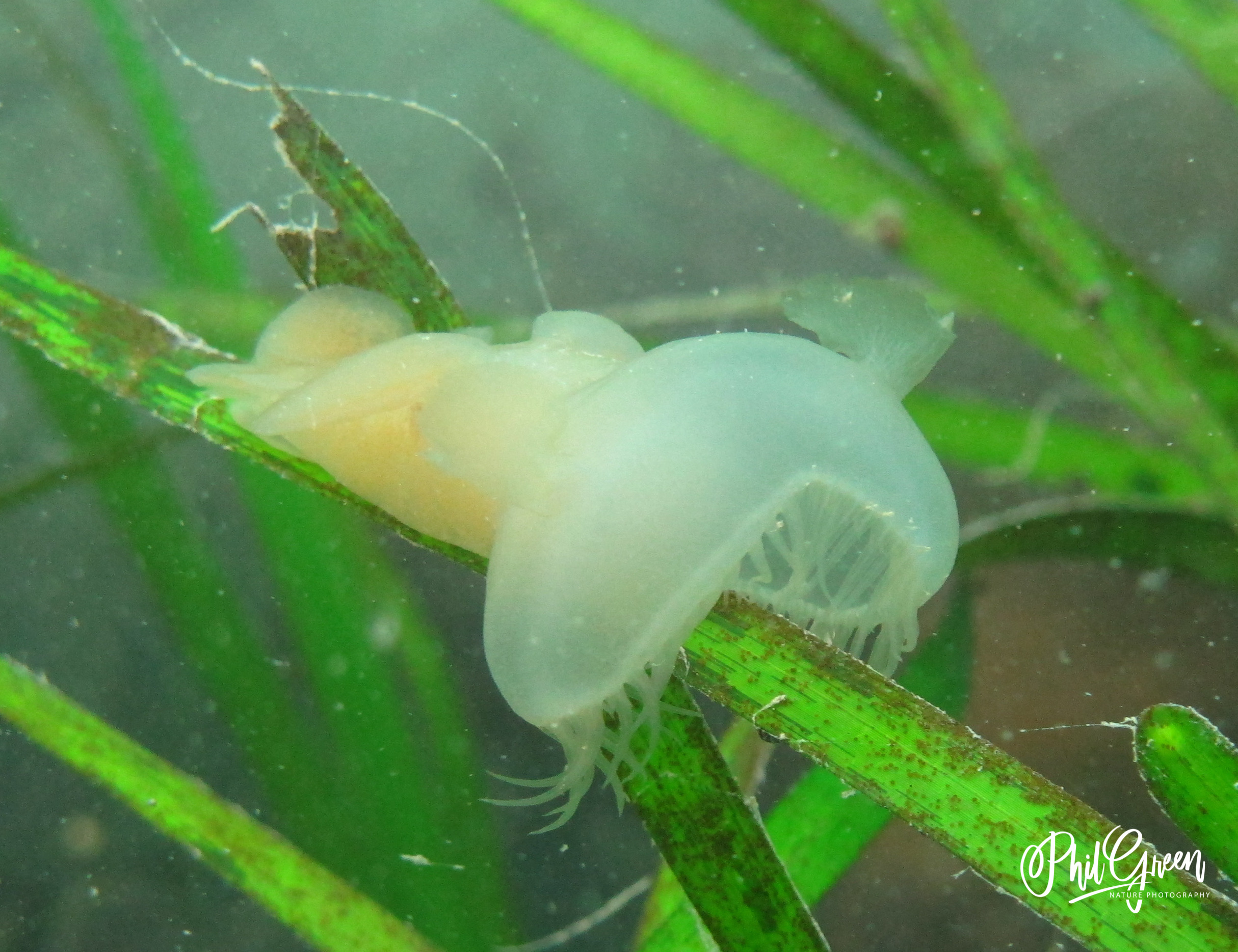 Hooded nudibranch in eelgrass,
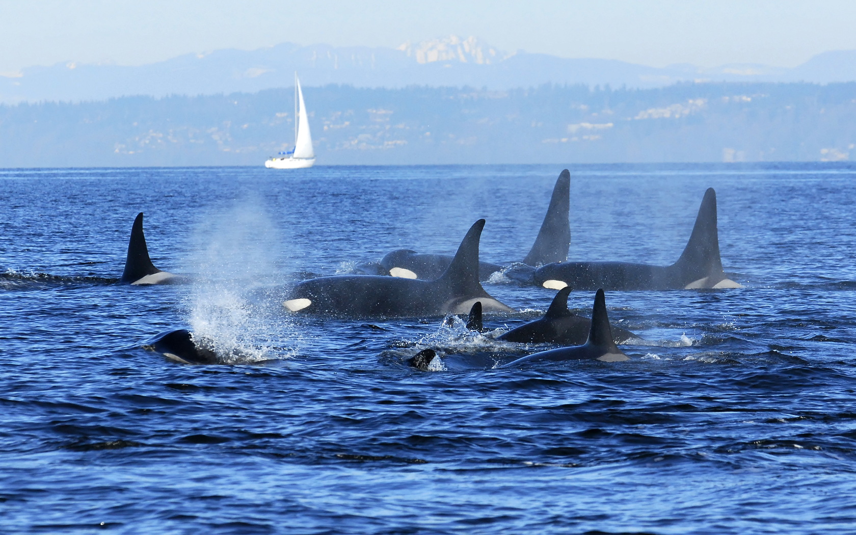 Southern Resident Orca,
 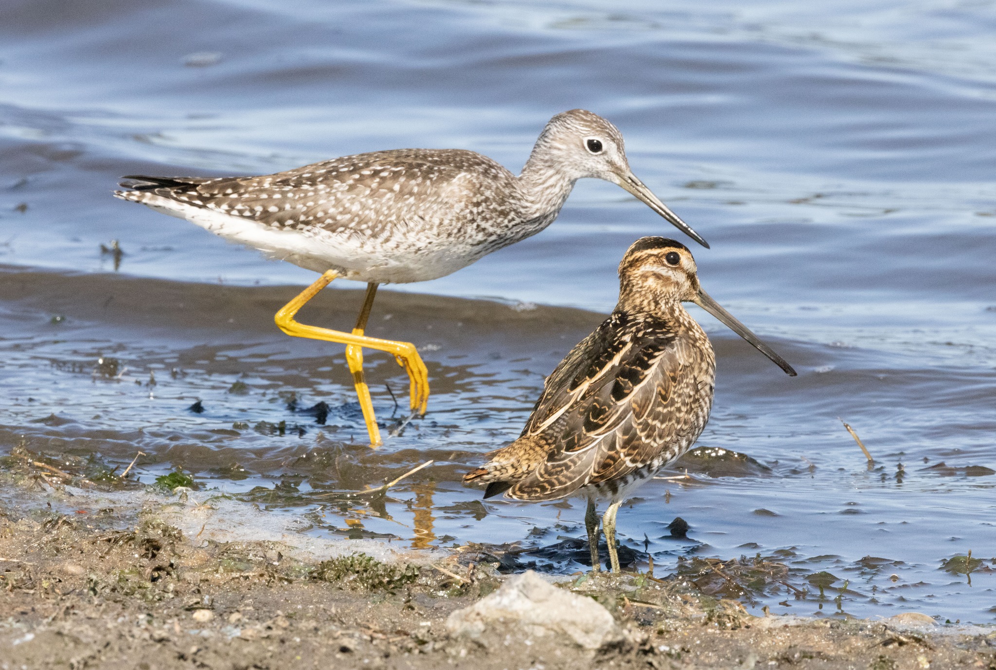 Greater Yellowlegs & Wilson Snipe,